Japan’s Most Beautiful Village - Kami Town Ojiro, Giant Tree Forest, Yoshitaki Falls
日本で最も美しい村~香美町小代 ~巨木の森と裏見の滝~吉滝~
 |
Route map
Route directions and land marks
- 1) Yoshitaki Campground Observation Deck
- Start at the "Yoshitaki Campsite Cottage Village Management Building". Walk down the paved slope for about 3 minutes till you reach "Yoshitaki Campground Observation Deck". Because the campground is located at a high altitude of 620m above sea level you can see over Ojiro ward, see beautiful starry skies at night and sometimes encounter a sea of clouds at dawn.
- 2) Three-way Street
- From the observation deck go down the road about 5 min. and there’ll be a three-way street. Turn right and continue down.
- 3) Another 3-way Street
- After 10 minutes you’ll come to another three-way street, proceed to the right of the directional signpost for Yoshitaki(吉滝)
- 4) Yoshitaki Parking Lot
- After about 10 minutes you should see a small parking lot, on the other side is the path we will use to get to “Yoshitaki Falls”. As you enter the path cedar, zelkova and other large trees will greet you on either side.
- 5) Nukida Genbugan
- When you have gone about 5 minutes, on the left there is “Nukida Genbugan” a basalt boulder that is said to have formed 1.3 million years ago. The contrast of the stones black shine when it’s wet and the green of the surrounding plants is splendid. After passing this you should soon come to a concrete bridge that will take you to Yoshitaki Falls, the valley’s view may captivated you from the bridge.
- 6) Yoshitaki Falls
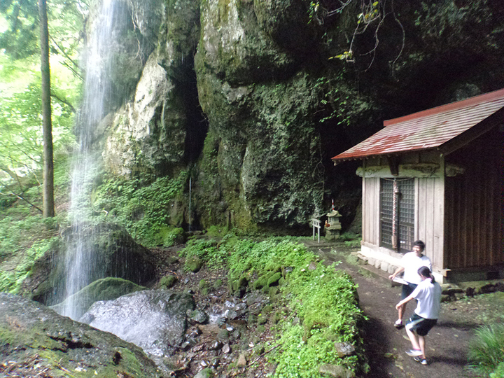
- From here proceed to “Yoshitaki Falls” also called the reverse waterfall because it can be seen from the backside. “Yoshitaki” is a Hyogo Prefecture Designated Natural Monument and is the only waterfall in the prefecture that has a height of 23m in the upper level and 5m in the lower. From the cracks of the bedrock to both sides of the fall are two thin waterfalls called “Kintaki (gold) Fall” and “Gintaki (silver) Fall”, called such as gold and silver powder looks to be glittering from them. The back of the fall’s basin looks like a small cave, in there is Yoshitaki Shrine. A said power spot that grants people love.
- 7) Shima Pond and Pasture
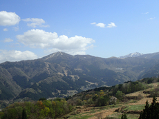
- Leaving Yoshitaki Falls you’ll reach the original road in about 20 minutes, on the right you’ll see a sloping hill and reservoir on the right side. This is “Shima Pond and Pasture”. Here vegetables are grown in the black soil fields that were dug into the gentle sloping lands created by landslips.”Tajima Beef” brand name cattle graze on the hills in the meadow. The perfect scenic spot to see Mt. Hachibuse and Torokawataira are laid out in the background and to see over Mt. Sobu.
- 8) Road Back
- Follow this route, the one you came on, back to where you first arrived.
- Route
- Yoshitaki Campground > Nukida Genbugan > Yoshitaki Falls > Shima Pond and Pasture > Yoshitaki Campground
- Difficulty
- ★☆☆
- Route Category
- Mountain and riverside
- Type of Activity


★☆☆ Flat course(Elevation gain less than 100m)or less than 5km.
★★☆ Slightly undulating course(Elevation gain less than 500m)or less than 10km.
★★★ Rugged course(Elevation gain more than 500m)or 11km.
★★☆ Slightly undulating course(Elevation gain less than 500m)or less than 10km.
★★★ Rugged course(Elevation gain more than 500m)or 11km.
| Distance | About 4.5km |
|---|---|
| Required Time | Walking time of about 1 hour 15 minutes. |
| Starting Point | Start / End point: Yoshitaki Campground |
| Getting Here | By Train & Bus: From JR Yoka Station take a Zentan Bus to Ojiro Otani (小代大谷) bus stop and get off here. By Car: Go to Yoshitaki Campground parking lot |
| Road Conditions | Asphalt, dirt |
| Resting Place | Public restroom: Yoshitaki Campground |
| Signpost Presence | Not Present |
| Guide Availability | Available Contact: Kami Town Ojiro Tourist Association (Ojiro Guide Club) Phone: 0796-97-2250 Fee: Inquire about fees |
| Notes | Parts or all of this path is impassable during winter. |
| Contact | Contact: Kasumi Town Ojiro Tourist Association Phone: 0796-97-2250 |
- Kinki Long-Distance Nature Trail - Mt. Taishi hiking course
- Nekozaki Peninsula Hiking Course
- Walk around Takeda Castle ruins and Teramachi Street
- The Famous Scenic "Kasumi Kaigan" Shiokaze Course
- Visit one of Japan's 100 most secluded regions, Torokawa Valley and Mt. Torokawa mountain trail.
- Mt. Sobu & Mt. Oosugii to Oonuka Mountain Trail
- Walking Hamasaka Town
- Yumura Onsen Course
- Moroyose Course
- Ueyama Highlands Course
- Tajima Mihonoura Course
- Home of Silkworm Culture - Osugi & Kuragaki Route
- Mining Town Walking Course in Akenobe
- View from Above the Sea of Japan - Aerial Train- Course
- Exploration of History Through Muraoka Castle Town
- Hachikita Kogen Scenic Walking Course
- Japan’s Most Beautiful Village - Tour Kami Town Ojiro & Kusube Valley Falls
- Japan’s Most Beautiful Village - Kami Town Ojiro, Giant Tree Forest, Yoshitaki Falls
- Walk Around Kuchiganaya in Ikuno Town
- Uduka History Course - Legend of the Rabbit Burial Mounds
- Uwano Nature & Interaction Forest Course
- Highland Course of a Shimmering Starry Forest and Pond
- See Oriental White Storks Dance in the Sky
- Walk the Town Where Oishi Riku Once Lived
- Along the Road Kinosaki Where Shiga Naoya Walked
- Blessings of the Earth, Walk Through the Town of Kawaminato
- Kannabe lava flow and crater course in a town where the world adventurer Uemura Naomi was born.
- A Course Through Serene Rural Landscape and a Rice Ball
- Japanese Heritage and Kitamae Ship Port "Moroyose Port" Course (Moroyose Short Course)


